Construction
Construction Drone Surveys, Mapping & Inspections | North Wales | Osprey sUAS
High-Resolution Drone Surveys for Construction, Pre-Planning & Project Management
Measurably accurate, safe and timely site data is essential at every stage of a construction project. From initial land assessments to progress monitoring and final validation, Osprey sUAS provides high-quality aerial surveys that enhance decision-making and significantly improve project efficiency.
Our drone surveys deliver the clarity, precision and perspective you need to manage construction sites effectively — captured quickly, safely and at a fraction of traditional survey costs, whilst also working hand-in-hand, combined.
Why Use Drones in Construction?
Traditional ground inspections and and manned aerial surveys can be:
- Difficult or unsafe to access
- Time-consuming and labour-intensive
- Expensive due to equipment and workforce needs
- Limited in perspective
- Slow to produce up-to-date information
Drone technology overcomes these limitations, providing fast, accurate, high-resolution data that supports construction planning, management and reporting.
Our Construction Aerial Survey Services
Osprey sUAS delivers professional, survey-grade aerial imaging for construction companies, developers, architects, planners and project managers.
✔ Pre-Planning Documentation
Capture detailed pre-construction imagery to support planning applications, feasibility studies and early design decisions.
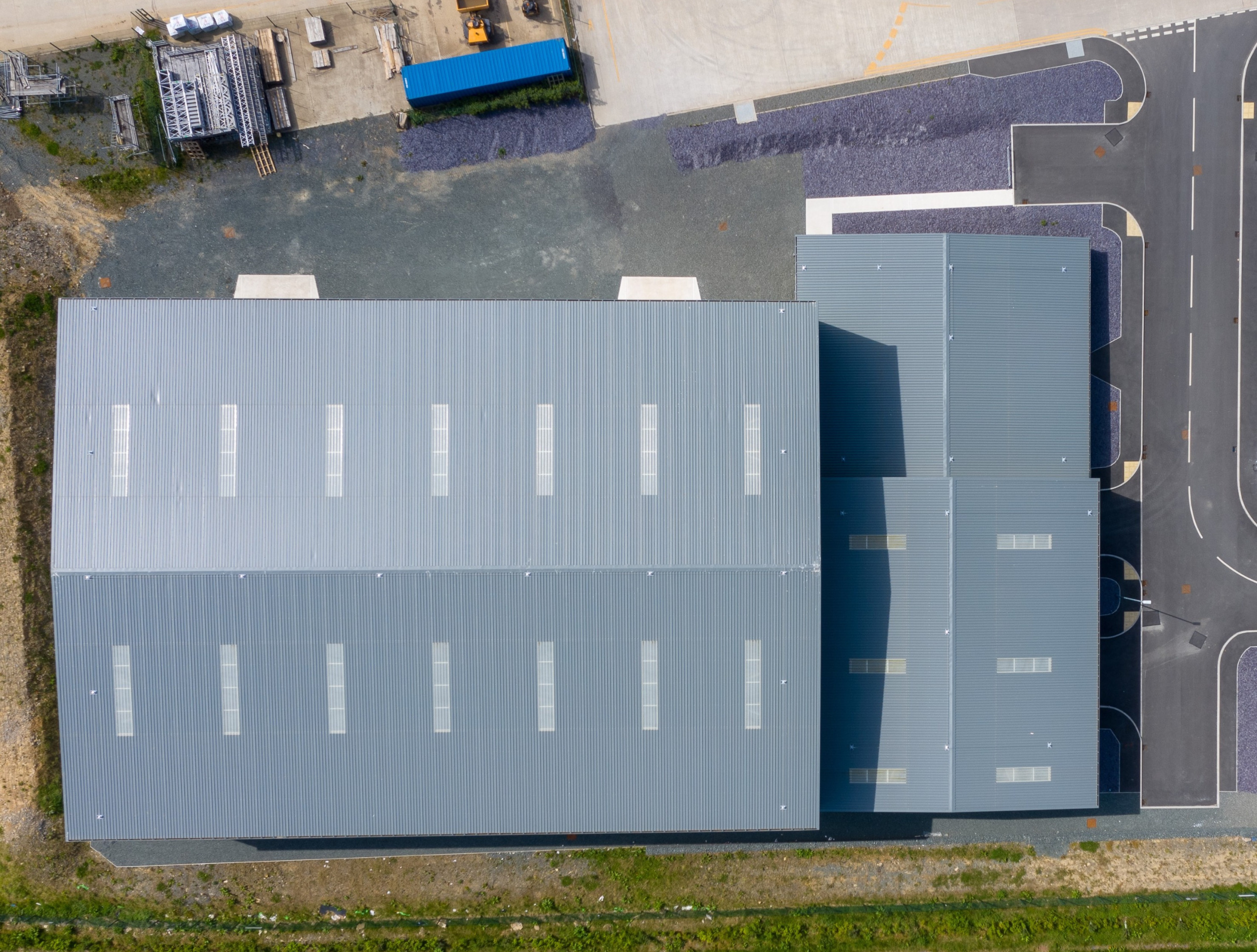
✔ Drone Mapping/Photogrammetry
Producing high-resolution models, geographically accurate, and measurable imagery with:
GSD 0.5–1 cm/px: Used for very high‑precision work and detailed inspection (cracks, roof defects, tight volumetrics, construction monitoring at low altitude).
GSD 1–2 cm/px: Common “professional survey” range, giving accurate topographic mapping and construction surveys with relative accuracy on the order of 1–3× GSD when combined with RTK/PPK or solid GCPs.
We use RTK, but can PPK the output with your ground based surveyors/engineers supplied GCP's, should you wish.
GSD 3-10 cm/pix: General site recce's, topographic surveys (corridors, sites, quarries, earthworks) where ~3–10 cm absolute accuracy is acceptable and you care more about coverage and efficiency than ultra‑fine detail.
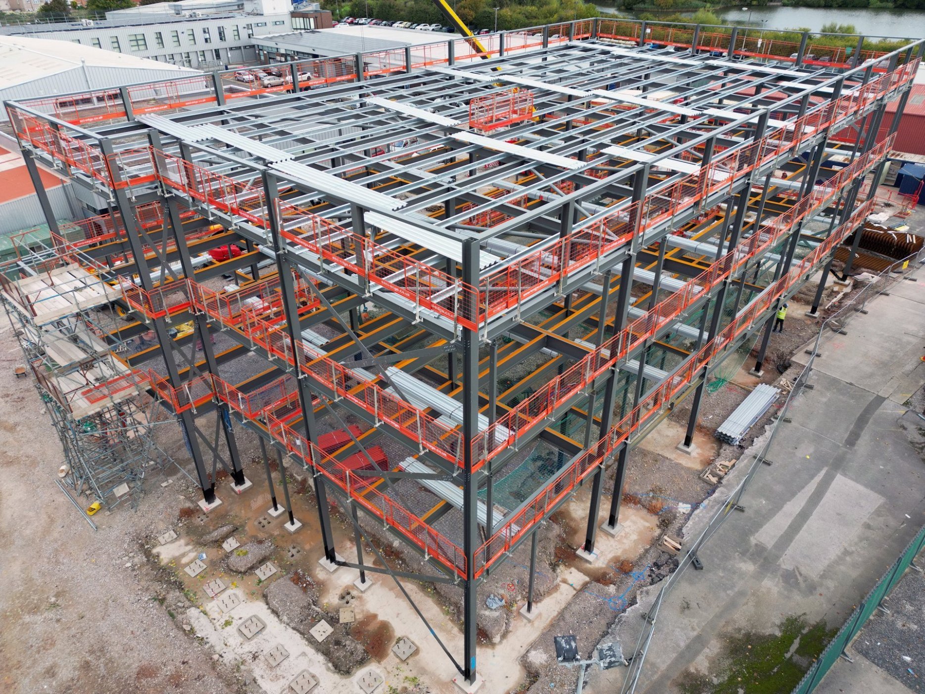
✔ Project Progress Monitoring
Cost saving analysis of project lifetime by tracking progress with consistent, repeatable aerial data for documentation, scheduling, reporting and project oversight.
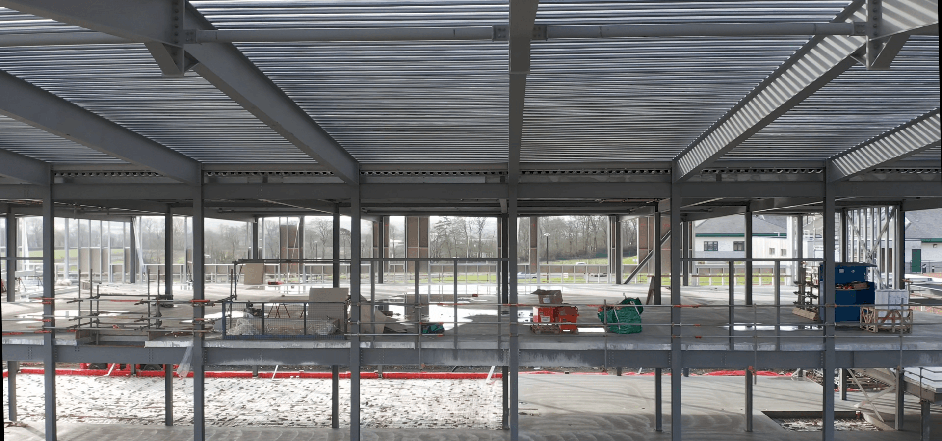
✔ Building & Structural Inspections
Inspect roofs, façades and hard-to-reach areas safely without scaffolding, cherry pickers or helicopter surveys.
✔ Visual Documentation for Stakeholders
Deliver clear, professional imagery and video for clients, investors and marketing teams — including final project showcases.
Fast, Scalable & Highly Accurate Data
Our drone systems provide:
- Real-time (at the point of capture) aerial views
- Coverage of tens of acres within an hour
- 200–300 acres captured in half a day
- High to ultra-high-definition imagery
- Rapid turnaround — within the hour for urgent requests, next-day as standard
- Full metadata for technical and survey applications
- Shareable Mobile/PC hi resolution models for remote stakeholder discussions
This offers a level of ground truth and image quality far superior to ground photography or satellite imagery.
Improve Site Management & Resource Planning
Drone data helps construction teams monitor:
- Site layout and logistics
- Equipment and plant utilisation
- Stockpiles, materials and temporary works
- Earthworks, excavation and grading
- Progress against schedule
- Health & safety compliance
Regular aerial captures enable faster, more informed decisions throughout the entire project lifecycle.
Construction Drone Services We Provide
Osprey sUAS supports all phases of construction with:
- Pre-purchase site surveys
- Pre-planning & planning-phase aerial surveys
- Site management and operational imagery
- Weekly or monthly build-phase updates
- Working-at-height inspections
- Pre- and post-works surveys
- Storm damage assessments
These services supply accurate visual data for planning, compliance, reporting and quality control.
Key Benefits of Osprey sUAS Drone Solutions
Our drone systems provide significant advantages across construction sites:
- Capture in hours, not days or weeks
- 2D/3D Models to share & discuss with stakeholders
- Reduce the need for scaffolding or powered access
- Access unsafe or sensitive areas without risk
- Minimise working-at-height hazards
- Produce clear, high-definition records for reporting
- Identify issues early with repeatable surveys
- Support insurance, warranty and QA documentation
- Lower operational costs and environmental impact
Safer, Faster & More Cost-Effective
Drone surveys dramatically reduce the risks and expenses associated with traditional inspection methods. Osprey sUAS provides a reliable, compliant and highly efficient aerial solution tailored for modern construction workflows.
Build with Confidence
Whether overseeing a small development or managing a multi-phase construction site, Osprey sUAS delivers the aerial intelligence you need to plan, track and complete your project with precision.
Contact us today to elevate your construction project with high-quality drone survey data.