Professional Drone Surveys & Inspections | Menai Bridge
INTRO
Osprey sUAS provides professional drone surveys and inspections across Menai Bridge and the surrounding areas on Anglesey, including the Menai Strait corridor and nearby coastal communities. We deliver high-resolution aerial data for residential properties, structural assets, coastal environments, and construction projects.
Our drone services provide a safe and efficient alternative to traditional access methods, helping homeowners and commercial clients inspect buildings, infrastructure, and coastal properties without the need for scaffolding or rope access.
LOCAL CONTEXT
Menai Bridge is defined by its iconic suspension bridge, tidal waters, and coastal housing, creating a unique environment for inspections. The combination of marine exposure, structural infrastructure, and hillside residential properties makes drone surveys especially valuable.
We support homeowners with roof inspections, chimney checks, and thermal imaging, particularly for properties exposed to coastal weather and salt air. We also assist with inspections of bridge structures, shoreline assets, and properties positioned along steep terrain or overlooking the strait.
RESIDENTIAL SERVICES
We provide residential drone services in Menai Bridge including:
• Roof inspections and condition surveys
• Thermal imaging for heat loss and damp
• Chimney, gutter, and fascia inspections
• Pre-purchase property surveys
• Coastal property condition checks
• Storm damage assessments
• Outbuilding and garden structure surveys
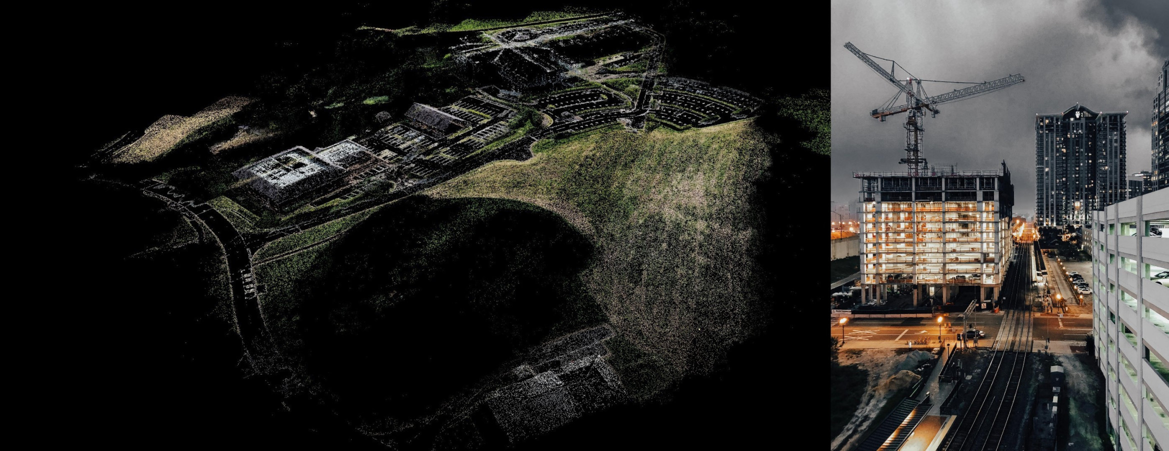
COMMERCIAL SERVICES
We support infrastructure and commercial clients with:
• Bridge and structural inspections
• Coastal and shoreline monitoring
• RTK mapping and topographic surveys
• 2D orthomosaic mapping
• 3D modelling and photogrammetry
• Construction progress monitoring
• Land and development surveys
COMPANY CAPABILITY & COMPLIANCE
Osprey sUAS operates a fleet of 5 UAV systems, including thermal platforms. Fully CAA compliant, insured up to £10M (with pre-approval to £20M), SafeContractor approved, and award-winning from 2020–2025.
TECHNICAL OUTPUTS
Our drone surveys deliver high-resolution, actionable datasets designed for professional use.
Typical outputs include:
- Orthomosaic maps.
- 3D models of buildings and terrain.
- Thermal imaging reports.
- Roof condition assessments.
- Measured site surveys for planning and design.
Homeowners who want a clearer view of roof damage, storm impact, damp ingress, or general property condition without needing intrusive access methods, will receive Hi-Res imagery and/or 4k video.
We also deliver **CAD-ready (DXF/DWG), BIM-compatible (IFC), and GIS (GeoTIFF/LAS) outputs including volumetric analysis.
These outputs are commonly used by engineers, architects, surveyors, and property professionals to make informed decisions quickly and accurately, and are also useful for homeowners who want clear evidence of roof condition, storm damage, or thermal performance in exposed coastal conditions.

CONCLUSION & CTA
Contact Osprey sUAS for drone surveys in Menai Bridge, supporting residential inspections, bridge monitoring, coastal surveys, and construction projects across the Menai Strait area.
.