Professional Drone Surveys & Inspections | Caernarfon
INTRO
Osprey sUAS provides professional drone surveys and inspections across Caernarfon and the surrounding areas in Gwynedd, near the Menai Strait and Snowdonia National Park.
We deliver high-resolution aerial data for residential properties, historic buildings, construction projects, tourism-related assets, and commercial buildings, supporting safe, efficient and informed decision-making for homeowners and commercial clients alike.
Our drone services are designed to replace or reduce the need for scaffolding, rope access, and disruptive ground-based inspections, providing fast and accurate aerial intelligence for both private residential properties and larger commercial or heritage projects in Caernarfon and beyond.
LOCAL CONTEXT
Caernarfon is a royal town and historic county town with a UNESCO World Heritage castle, medieval town walls, and a mix of terraced housing, period properties, and modern residential developments. The town's rich heritage, tourism focus, and setting between the mountains and the Menai Strait create strong demand for non-invasive inspection methods, especially for older buildings and properties with difficult access.
We support property managers and homeowners in Caernarfon with roof inspections, chimney and gutter checks, thermal imaging for heat loss and moisture, and condition assessments for domestic properties, including period homes within and around the historic town walls.
Drone surveys are particularly valuable for steep roofs, historic buildings, and properties close to the castle and waterfront.
The surrounding area includes Snowdonia foothills, rural farmland, coastal zones, and the Menai Strait, which can make traditional access methods slow or unsafe. Drone inspections offer a practical alternative for monitoring weather damage, roof degradation, and hard-to-reach structures across the town and surrounding countryside.
RESIDENTIAL SERVICES
We provide residential-focused drone services for homeowners, landlords, and letting agents in Caernarfon, including:
- Residential roof inspections.
-
Thermal imaging for heat loss, damp, and moisture issues.
- Chimney, gutter, and parapet checks.
- Storm-damage assessments after mountain and coastal weather events.
- Pre-purchase property inspections.
- Holiday let and second-home condition checks.
- Period property and historic building inspections.
- Garden and outbuilding surveys.
These services help homeowners and landlords maintain their properties safely and cost-effectively, without the expense or disruption of scaffolding or manual access, especially around the historic town and waterfront.
COMMERCIAL SERVICES
We also support commercial, heritage, and public-sector clients in Caernarfon and the wider Gwynedd area, including:
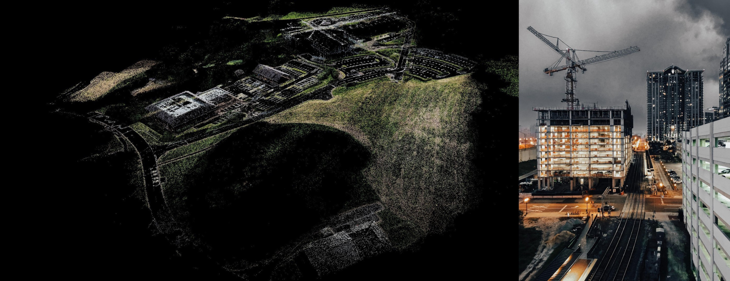
- Construction progress monitoring.
- RTK drone mapping and topographic surveys.
- 2D orthomosaic mapping.
- 3D modelling and photogrammetry.
- Heritage and castle-related inspections.
- Tourism infrastructure monitoring.
- Commercial roof inspections.
-
Land and development surveys for planning.
This ensures our drone services are equally suited to heritage projects, tourism infrastructure, and commercial developments as they are to private residential inspections.
COMPANY CAPABILITY & COMPLIANCE
At Osprey sUAS, we operate a fleet of 5 UAV systems, including thermal imaging platforms.
We are fully CAA compliant, insured up to £10M with pre-approval up to £20M, SafeContractor approved, and award-winning from 2020 to 2025.
All operations are conducted with strict safety procedures, ensuring accurate, repeatable, and regulation-compliant aerial data capture suitable for engineering, construction, environmental, and property sectors.
TECHNICAL OUTPUTS
Our drone surveys deliver high-resolution, actionable datasets designed for professional use.
Typical outputs include:
- Orthomosaic maps.
- 3D models of buildings and terrain.
- Thermal imaging reports.
- Roof condition assessments.
- Measured site surveys for planning and design.
Homeowners who want a clearer view of roof damage, storm impact, damp ingress, or general property condition without needing intrusive access methods, will receive Hi-Res imagery and/or 4k video.
We also deliver **CAD-ready (DXF/DWG), BIM-compatible (IFC), and GIS (GeoTIFF/LAS) outputs including volumetric analysis.
These outputs are commonly used by engineers, architects, surveyors, and property professionals to make informed decisions quickly and accurately, and are also useful for homeowners who want clear evidence of roof condition, storm damage, or thermal performance in exposed coastal conditions.
CONCLUSION & CTA
Certified and insured drone operator delivering reliable aerial insights across Caernarfon and the surrounding Gwynedd countryside.
Contact Osprey sUAS to discuss your Caernarfon drone survey requirements, whether for residential property inspections, holiday let checks, heritage building surveys, storm-damage assessments, construction projects, or tourism infrastructure monitoring.