Professional Drone Surveys & Inspections | Rhyl
INTRO
Osprey sUAS provides professional drone surveys and inspections across Rhyl and the North Wales coastline, supporting residential, regeneration, and coastal infrastructure projects.
LOCAL CONTEXT
Rhyl is characterised by high-density housing, coastal exposure, and flood risk zones, making drone inspections highly effective for both residential and public sector applications.
We assist homeowners with roof inspections and storm damage surveys, particularly following coastal weather events, and support large-scale regeneration and infrastructure monitoring.
RESIDENTIAL SERVICES
• Roof inspections
• Storm damage surveys
• Thermal imaging
• Pre-purchase property checks
• Chimney and gutter inspections
• Flood impact assessments
COMMERCIAL SERVICES
• Coastal defence inspections
• Flood risk monitoring
• Construction progress tracking
• Housing estate surveys
• Mapping and photogrammetry
COMPANY CAPABILITY & COMPLIANCE
CAA compliant, fully insured UAV operator delivering fast and safe inspection services.
TECHNICAL OUTPUTS
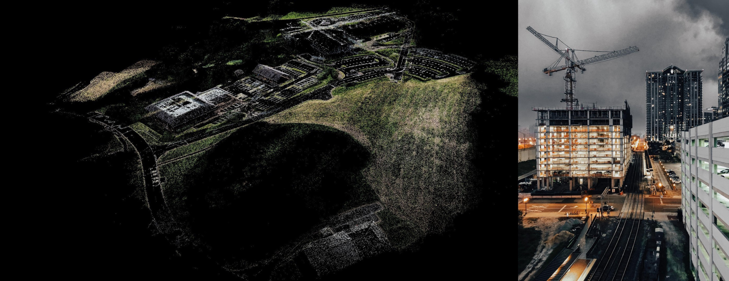
Our drone surveys deliver high-resolution, actionable datasets designed for professional use.
Typical outputs include:
- Orthomosaic maps.
- 3D models of buildings and terrain.
- Thermal imaging reports.
- Roof condition assessments.
- Measured site surveys for planning and design.
Homeowners who want a clearer view of roof damage, storm impact, damp ingress, or general property condition without needing intrusive access methods, will receive Hi-Res imagery and/or 4k video.
We also deliver **CAD-ready (DXF/DWG), BIM-compatible (IFC), and GIS (GeoTIFF/LAS) outputs including volumetric analysis.
These outputs are commonly used by engineers, architects, surveyors, and property professionals to make informed decisions quickly and accurately, and are also useful for homeowners who want clear evidence of roof condition, storm damage, or thermal performance in exposed coastal conditions.

CONCLUSION & CTA
Contact Osprey sUAS for drone surveys in Rhyl, supporting residential inspections, coastal monitoring, and regeneration projects.